Extraordinary Maps
Categories: Art | Beauty | Design and Architecture | Photo project | World
By Vika https://mail.pictolic.com/article/extraordinary-maps.htmlThese are some strange, peculiar, or curious maps of the world. I collected and chose them because I consider them worthy of admiration for their concepts or their aesthetics.
8 PHOTOS
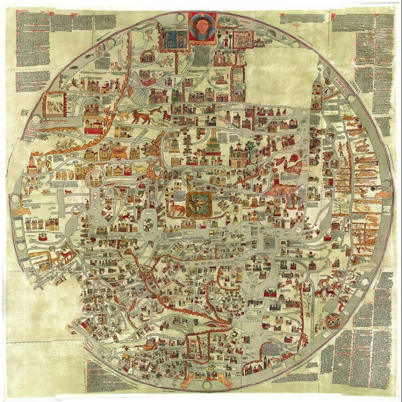
1. Ebstorf map (1300)
This map is considered a historical curiosity, not only for being the largest in the known medieval world but for being the work of the female hands of the Ebstorf convent. It shows Christ as the world and in the center the mythical earthly paradise surrounded by a wall of fire.
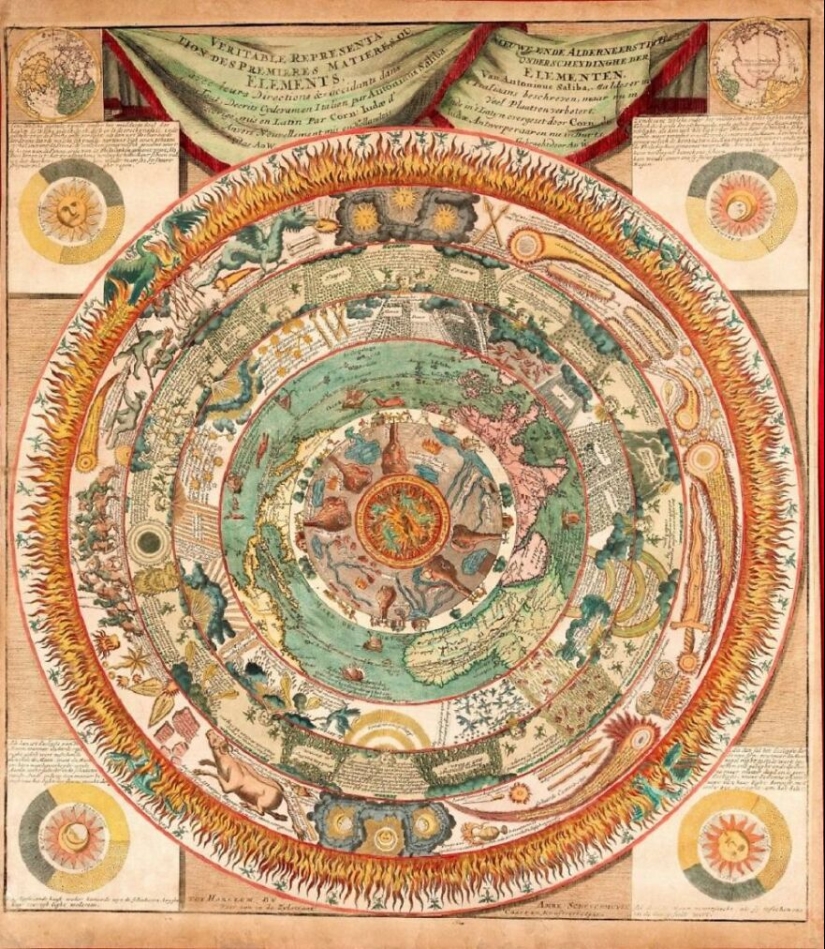
2. Map of the raw materials of the elements (1600)
This world map made by Antonino de Saliba in 1600, shows in a series of rings the ethereal kingdom of demons (phoenixes and salamanders), the celestial vault, climatic phenomena, crops, the known world, the earth, rivers and volcanoes, to finally end in the center with hell.
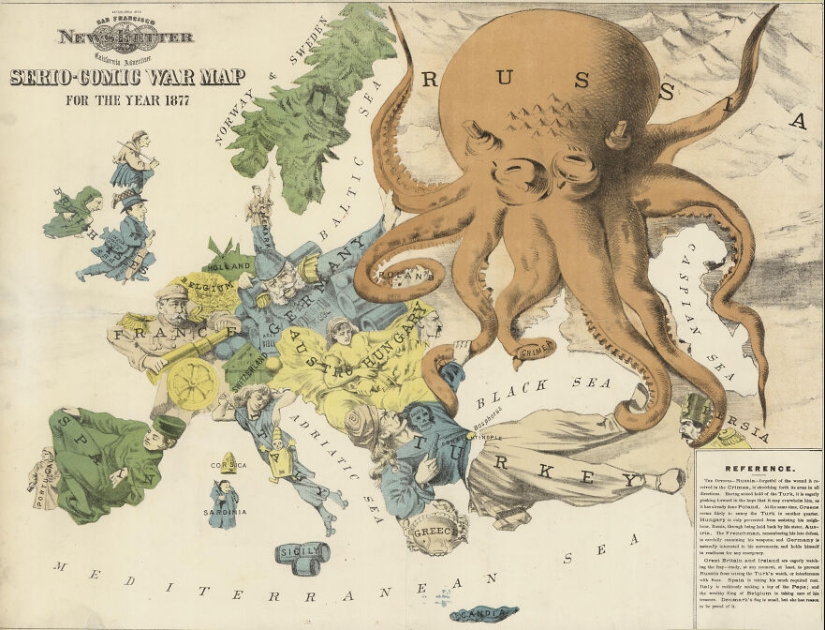
3. Serio-comic war map (1877)
Published in 1877 after the Russian Empire attacked the Ottoman Empire, the British Frederick W. Rose decided to represent Europe in this way.
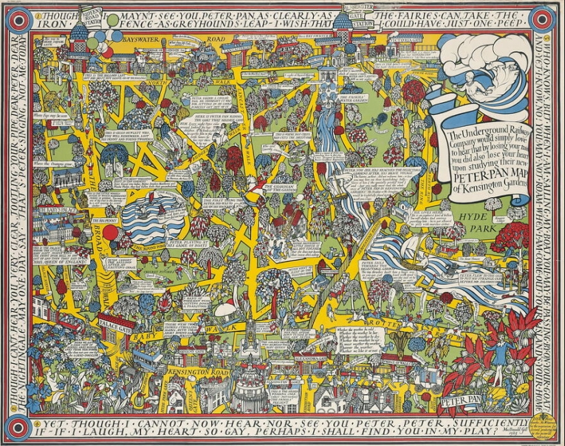
4. Peter Pan's map of Kensington Gardens (1923)
Inspired by a sculpture of Peter Pan, this map was designed in 1923 to decorate public transport in London in order to entertain passengers waiting for the train. It is a mixture of reality and fiction of actions that fantastic characters carry out in the surroundings.
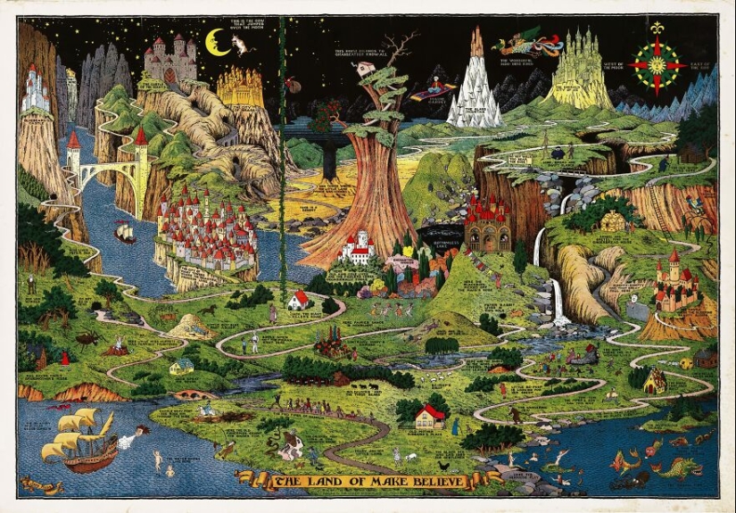
5. The land of make-believe map (1930)
This map by Czech cartoonist Jaro Hess shows all the rhymes, children’s stories, and popular songs in a fictional space. It is possible to find Little Red Riding Hood, Humpty Dumpty, and the plant that grew to heaven from Johnny and the beans.
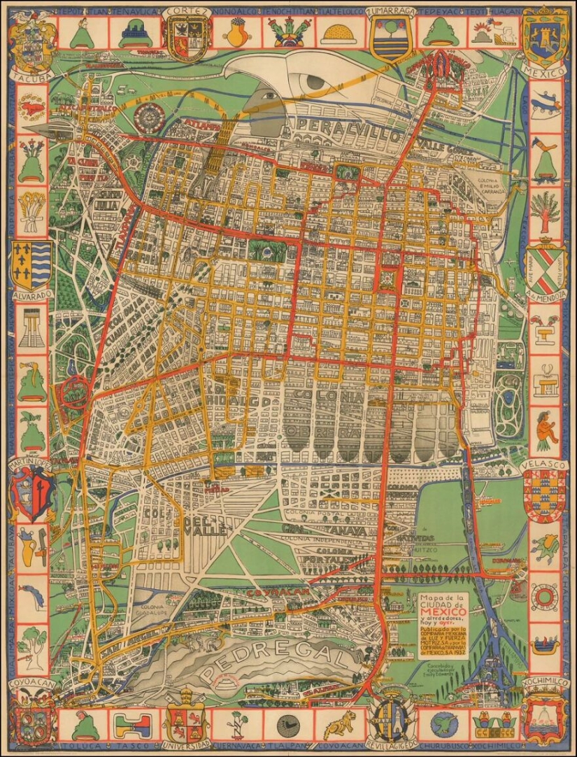
6. Mexico City map (1932)
Map of Mexico City in 1932 designed by Emily Edwards where the city is represented as an Aztec eagle warrior.
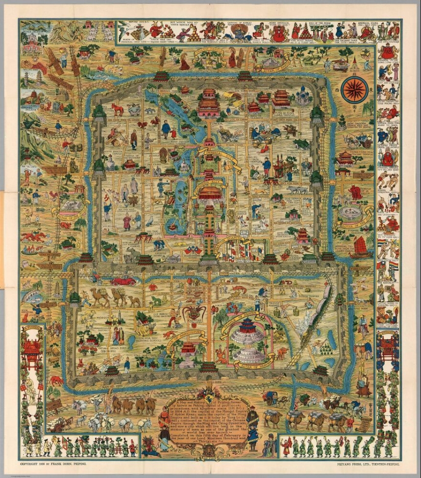
7. History of Beijing map (1936)
Created by Frank Dorn, this tourist map shows not only the inside and outside of the Forbidden City but also illustrations of the city’s history both inside and on the frame.
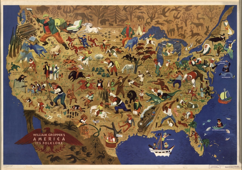
8. America its Folklore Map (1946)
This map was created by William Gropper to illustrate American legends, myths, and folk tales. There it is possible to see everything from the Salem witches to the Mormon myth of the sacred writings found in Utah.
Keywords: Extraordinary maps | Map designs | World | Maps of the world
Post News ArticleRecent articles

It's high time to admit that this whole hipster idea has gone too far. The concept has become so popular that even restaurants have ...

There is a perception that people only use 10% of their brain potential. But the heroes of our review, apparently, found a way to ...
Related articles

Have you heard of such a phenomenon as the doorway effect? Let's put it simply: have you ever walked into a room and immediately ...

Walking through this picturesque bridges, you can admire the views from these stunning views and breathtaking landscapes. We invite ...

Not all the house where they filmed the cult movies and TV shows, become "house-museums". Many of them are then sold as the ...

New Year's is a time to surprise and delight loved ones not only with gifts but also with a unique presentation of the holiday ...